12 August 2019

W7A/SC-001 Josephine Peak and W7A/AE-014 Mt Wrightson

The Santa Rita Mountains are South of Tucson and contain some beautiful trails.  The high point is Mt Wrightson, which I have previously blogged about; at 9,453 feet elevation, it is higher than Mt. Lemmon in the Santa Catalina range.  But since the summits in the Santa Ritas don't have a public road to the top, they provide a much nicer wilderness experience.

Hiking Wrightson alone is a good challenge, but the trail system in the area provides a great double-activation opportunity for hams who want a tough but rewarding day.  The "Super Trail" loop around Mt. Wrightson goes past Josephine Peak, a 10-pointer that is almost 1,000 feet lower than the summit of Wrightson, but is actually considerably harder to reach.


I've done this double twice as of this writing, first on March 8, 2018, and second on July 26, 2019.  The March hike was cooler, but the July hike provided more daylight hours.  In March, there was still snow on the trail above 8,500 feet; in July, a monsoon storm actually prevented me from completing the activation of Wrightson, although I did reach the summit.  Overall, I'd recommend late fall or spring as the best time of year to do this double.

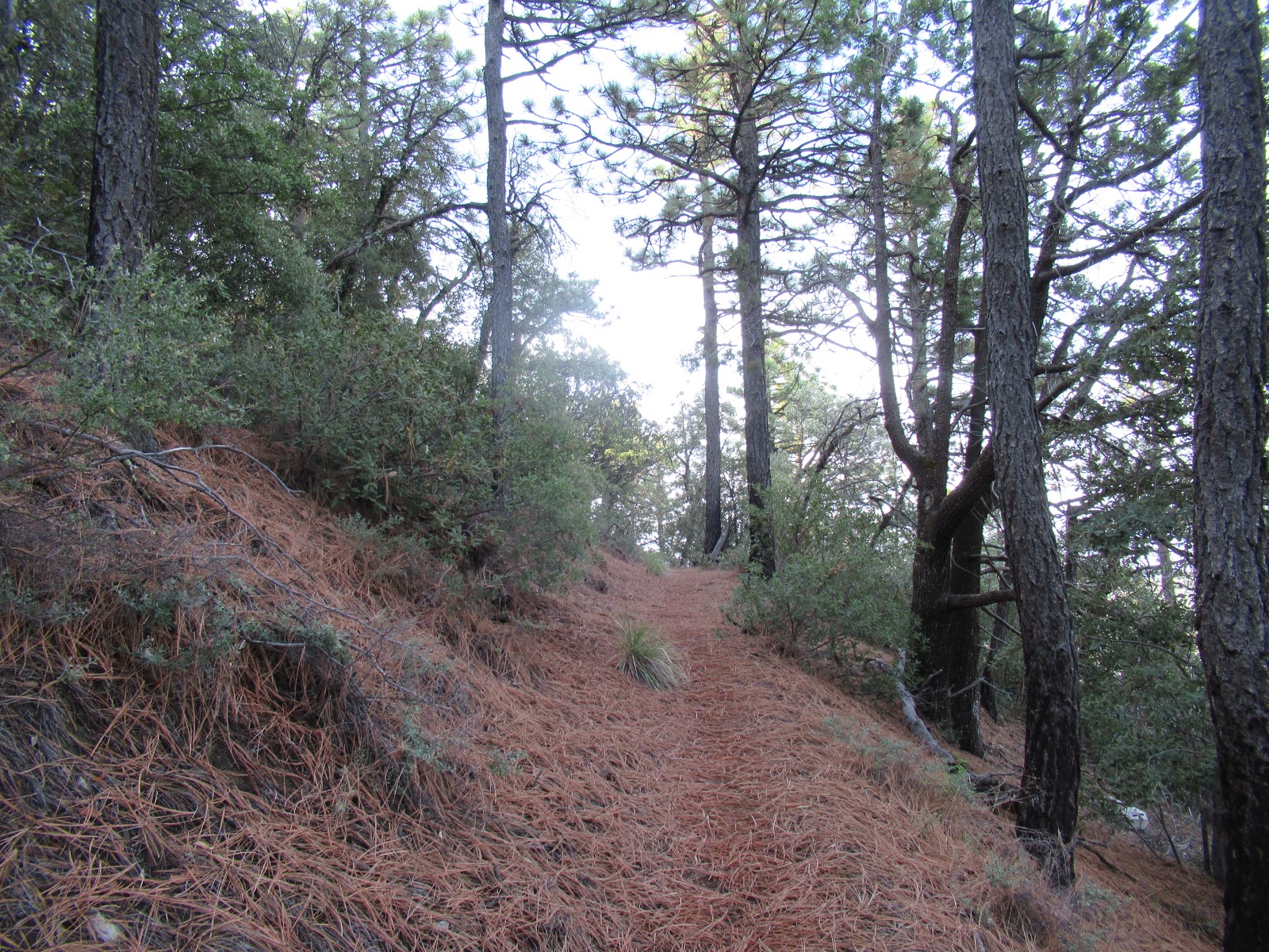
Starting from the top of the road in Madera Canyon, I took the Old Baldy Trail up towards Josephine Saddle.  It's a steep trail but very beautiful.  On the way up, sometimes there is wildlife to be seen - I spotted a few deer in July, but I have not yet seen a bear there, although they do live in the area.


Upon reaching the Saddle, there is a plaque to commemorate the passing of some Boy Scouts who were caught in a storm in 1958.


At the saddle I turned left to head up towards Mt. Wrightson.  The Super Trail turnoff is a bit further up the trail and although there is a sign, it could easily be missed as it clearly does not get the same usage.


Hiking generally Eastward on the Super Trail takes you towards Josephine Peak.  This section of the hike continues the climb, and is less traveled but quite nice.


Along the way, Mount Hopkins looms with its giant observatory building prominently guarding the summit.  This is also a 10-point summit, and I'll blog about this one in another post.


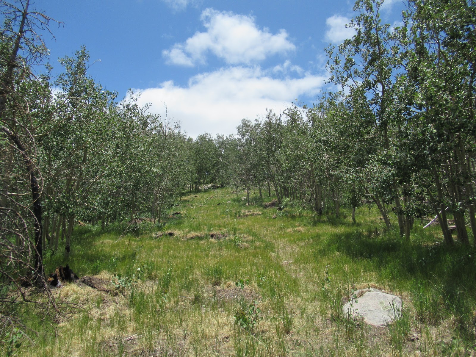
When the first view of Josephine opens up, it's both spectacularly beautiful and a bit intimidating.  This is heavily forested mountain terrain!


Somewhere around 4 miles in, the trail reaches Riley Saddle.  There is a sign pointing to Josephine Peak.  This is where things begin to get interesting!


Apparently, there had been a trail to the peak in the past, but it was obliterated by the Florida Fire in 2005.  When I hiked in March 2018, someone had begun rebuilding a trail, at least for the first quarter mile or so.  Apparently the USFS did not appreciate this and in 2019, I discovered that the trail was mostly gone, and a few of these signs were posted warning hikers against unauthorized trail building.


From Riley Saddle to the top, the hike becomes a very challenging bushwhack, with some very dense sections and some very steep sections.  It's actually easy to get into a dangerous place during this bushwhack!


In March, I tried a route up that put me into some extreme exposure; a fall would have been devastating.  In July, I foolishly took a route up a steep gully with the hope of saving some distance; upon reaching the top, I found myself facing into a deep cave that appeared to be "occupied" and I had to scramble back down, again praying not to fall and feeling fortunate that I didn't get eaten by some large fluffy creature.  The best way to avoid serious danger on this bushwhack is to steer to the left (North) face, and go up in the treefall there, rather than try to scramble up through the rocky sections on the Western side.

The top of Josephine is actually a nice spot to activate, with bushes and rocks available to put a mast up, but no shade.


During the summer months, ladybugs sometimes come out in force at high elevation.  They can be a bit overwhelming...and yes they do occasionally bite!


After activating Josephine, the focus turns to Mt Wrightson, which is majestic during the bushwhack back down.


Upon reaching the Super Trail, rather than turn left to return from where I came, I turned right (NE) to begin the trek towards the summit of Mt. Wrightson.  On this side of the peak, the trail is a bit less forested and more rugged than on the West-facing side.  It's about 3 more miles from Josephine to Wrightson, but with the bushwhacking and climbing it does take a while.


The summer season in Southern Arizona can have some bad monsoon storms.   During my hike in July, when I looked back towards Josephine, I noticed dark clouds forming which had not been there earlier.


Sure enough, the rain began soon aftewards.  I didn't mind the cooling effect of the rain, but it made me nervous about whether the weather would prevent me from completing the double activation.  Not hearing any thunder at all, I decided to forge ahead.  The rain eased up a bit as I approached the saddle below Mt Wrightson.


In March, this area had snow, although it wasn't deep.  March is late in the season here, so it's possible to find the ground dry, snow-dusted, or even heavy snow.  As the hike approaches the summit, there is a fairly steep series of narrow switchbacks that are a lot of fun to hike.  When it's snowy, they can even be difficult to negotiate; fortunately, during my hike the snow wasn't bad enough to create any serious challenge.


The top of Mt Wrightson is quite exposed and definitely not a good place to be during a thunderstorm.  Unfortunately, during my July 2019 hike, although I reached the top, I did not activate.  I actually was pushing up my mast, with the dipole hanging off the top, and just as it reached maximum height, a huge CRACK and a boom of thunder just about startled me out of my hiking boots!  I jumped and snagged my antenna's wire, ripping it out of the balun at the top...and proceeded to pull the mast down in record time.  I threw my stuff into the bag and made haste to get off the high point asap.


The hike down from Wrightson is quite beautiful.  There are a couple of springs along the path, and plenty of greenery on the Western side of the peak.


Either of these two summits is an honest day's work to activate; but their unique location and the trail design allows them to be combined for anyone looking for a good hard challenge.

One odd fact about these two summits:  Josephine Peak is in the "SC" region and thus qualifies for the SOTA Summer Bonus.  However, Mt. Wrightson is in the "AE" region, and thus qualifies for the SOTA Winter Bonus.  This despite the fact that they are both in the same grid square!

Date First Activated as a Double by KR7RK:  08 Mar 2018
GPS Track Uploaded to SOTA Mapping Project Tracks Site:  Yes
Approx Hiking Distance:  14.2 mi
Approx Elevation Gain:  4,600'
Summit Elevation:  8,478' (Josephine Peak), 9,453' (Mt Wrightson)
Summit Grid Square:  DM41nq (both summits)
Summit County:  Santa Cruz
ITU Zone:  6
CQ Zone:  3


04 August 2019

W7A/CO-002, Ramsey Peak and W7A/AE-013, Miller Peak

I was desiring a very long hike after my busy season ended, so early in the morning of April 18th, 2019, I got up early and made the long drive from Oro Valley to the Ramsey Vista Campground in the Huachuca Mountains.  This mountain range lies along the US/Mexico Border, near the town of Sierra Vista.  My targets for the day were two summits, W7A/CO-002 Ramsey Peak, and W7A/AE-013 Miller Peak.  I actually thought there might be a possibility to add a third summit, W7A/CO-001 Carr Peak, which I had previously activated, but only if time permitted - as it turned out, I skipped Carr.

I parked in the campground, hung my USFS pass in the window, and began my day of hiking about 7am.  Early on, I could see the mountain looming in the distance, its rocky eastern sides looking rather intimidating.


Starting on the Hamburg Trail, I began the hike.  The first 2.5 miles or so were actually downhill, dropping about 700' into Pat Scott Canyon and the Hamburg Mine.  It was nice and cool, with a decent trail and plenty of trees.  I even found some running water in a few places.


After the canyon, the steep climb began with multiple switchbacks.


Ramsey Peak was drawing closer, and continued to look rather interesting.


At about 4.7 miles in, I reached a junction with the Crest Trail.  Turning North, I took a path that would take me across Pat Scott Peak on the way to Ramsey.  There were some interesting sights including some discarded old mining equipment (which is not unusual in Arizona).


There were a few sections with steeper climbs and more evidence of human presence from days gone by as I continued onward.


Eventually the trail became less apparent - there clearly were not as many hikers who go this far up.  But it did level out for a while and was pleasantly forested.  I saw a deer run by and breathed in the fresh air as I prepared for the coming bushwhack.


At about the 5.5 mile mark, I reached a boundary sign to inform me that the trail was about to enter the Fort Huachuca Army Base.  This is where the bushwhack to the summit begins, and there is a fence to define the boundary of the Coronado National Forest and the US Military property.  Although I doubted that the army would have anyone stationed up there, I decided it was probably best not to be bushwhacking through the forest on the military side of the fence.


So, I began the final ascent up to the summit.  At first, it looked relatively simple - a mild slope in the pines.  However, that did not last long! 


It was a tough, dense, and at times rather steep bushwhack to the summit.  It took me almost another hour to hike that final mile.  But I did reach the summit, and had a nice activation starting at about 11am.  I was testing out a shorter (and lighter) push-up mast so my antenna wasn't quite as high as normal, but it all worked out well.


Since I had plenty of hiking ahead, I only ran 20 and 40 meters, for about 45 minutes, before packing up.  The bushwhack down was just as rough, and I was glad to be back on trail after a mile down.  I headed back along the Crest Trail, but at the junction I kept on going instead of turning back down towards the canyon.  I was really enjoying this trail, being alone in the quiet forest, with plenty of scenery.


There are quite a few trails in the Huachucas, but fortunately I had carefully mapped out my route and saved it to my GPS in advance.  The Crest Trail is actually part of the Arizona Trail, and although I didn't see any other hikers all day, I'm sure there had probably been some through-hikers in this area within the past few months.


Some areas of the hike took me through sections that had obviously experienced forest fires.


My second summit target, Miller Peak, was a fairly good hike away from Ramsey.  Around 5 miles into the hike between the summits, I reached what I believe was "Bathtub Spring".  This is also a trail junction and I stopped to take a drink before starting the next climbing section.  I was very sweaty and grubby by this time, but I decided not to take a bath.


Continuing on, I soon saw Miller Peak tempting me in the distance, roughly 2.5 miles away, and about 700 feet higher.


I was beginning to get a bit tired at this point but the magic of the outdoors kept me feeling excited.  As I got higher, there were even a few sections of trail that had a snowy surprise to cool me off.


I reached the final spur trail to Miller Peak and turned up for the final ascent.  It was rocky and rough, but not too far to reach the summit.


I set up and began operating about 4pm, but kept it very short as it was chilly and I knew I only had a few hours of daylight to finish my hike.


The hike out was very nice, with long shadows and the stillness that slowly takes over wilderness as evening approaches.  At one point I saw a deer who seemed surprised to see a human out here in his domain.


I walked so close to Carr Peak, in fact my final section of the hike took me right past the summit and around it, but there simply was not enough time to scurry up and activate.  When I came around to the North side of the peak, I could see into Sierra Vista, and nearby was the famous tethered border surveillance blimp that has kept an eye on the area for many years.


The hike down after Carr Peak is rather steep and rocky, which was a bit tricky to navigate safely in low light.


I finished the hike right when twilight was pretty much done.  The moon was full and was peeking through the treetops to add a mystical aura to the finish. The total mileage for the hike was 20.2 miles, with total elevation gain of around 5,400 feet.  I was tired but very happy!


Date First Activated by KR7RK:  18 Apr 2019
GPS Track Uploaded to SOTA Mapping Project Tracks Site:  Yes
Approx Hiking Distance:  20.2 mi
Approx Elevation Gain:  5,400'
Summit Elevation:  8,737' (Ramsey Peak), 9,466' (Miller Peak)
Summit Grid Square:  DM41tk (Ramsey Peak), DM41uj (Miller Peak)
Summit County:  Cochise
ITU Zone:  6
CQ Zone:  3

24 July 2019

W7A/AE-011, Heliograph Peak

Heliograph Peak is a special summit for me, because it's where I got my start with Summits On The Air.  See this post from July 16, 2016 for a blog about that first adventure that I had with my friend Quinton, NU7Y.

Two years later, I was fully immersed in the addiction of ham radio and summit hikes.  I had activated enough to reach "Mountain Goat" status, which requires attaining 1,000 points using the SOTA scoring system.  I wanted to return to Heliograph Peak, which is worth 10 points, to cross that 1,000 point mark and earn my MG, so on July 6, 2018, I headed towards the Pinaleno Mountains for some fun.

I first hiked to, and activated, W7A/AE-010 Webb Peak, which is just a bit further down the road from Heliograph and makes for a nice double-activation option.  It was a nice cool day and there were a few light rain showers but nothing to prevent a good activation.

There are at least two main routes up to the summit of Heliograph.  The longer option is actually the easier way, because it involves hiking up a dirt road for about 2.3 miles with a bit under 1,000 feet elevation gain.  The shorter option is to hike up a trail for about 2 miles, which is steeper with roughly 1,100 feet of gain.  I've posted tracks for both to the SOTA Mapping Projects Tracks page.  I think the trail option is more scenic but they both are pretty good and you can combine them since the starting point is nearly the same either way.


For my MG activation, I took the trail.  There was some fire damage evident from the 2017 Frye Fire, but overall it was in decent condition.


Towards the top, the trail does get steeper, and became somewhat vague - because it had only recently re-opened after the fire, there had not been a lot of use to keep it well-defined, but there wasn't much chance of getting lost.


There are commercial towers and a fire lookout on top, but the summit is fairly broad and has plenty of space to set up a SOTA station.  Here is a 360 summit view video (split into two due to size limits):


It was a wonderful day, and some of the same Chasers who showed up in my log from that first SOTA activation in 2016 gave me contacts again in 2018, which was fun.  And of course, first in my log was NU7Y!  I did cross the 1,000 points level, and a couple of months later received this nice glass trophy to commemorate earning SOTA Mountain Goat.


Heliograph is in the Coronado National Forest, and is managed by the Safford Ranger District.  I found them to be helpful when I called to confirm the status of the area - there are many fires in Arizona and they often result in closures, and sometimes information on the internet is not current.

Date First Activated by KR7RK:  16 July 2016
GPS Track Uploaded to SOTA Mapping Project Tracks Site:  Yes
Approx Hiking Distance:  4.1 - 4.5 mi
Approx Elevation Gain:  1,000'
Summit Elevation:  10,022'
Summit Grid Square:  DM52bp
Summit County:  Graham
ITU Zone:  6
CQ Zone:  3

W7A/AE-010, Webb Peak

The Pinaleno Mountains in Southern Arizona contain some high summits and provide an opportunity to find some cooler temperatures during the warmer months.  Mount Graham is the highest, but it is off limits to most due to the observatories and to protect the endangered Red Squirrel population.  Other summits are accessible, though, including Webb Peak.  I chose to activate Webb Peak in July, 2018, as my first of two summits on the day I reached the Summits On The Air "Mountain Goat" status.

It's a long drive from Tucson to the trailhead - roughly 3.5 hours.  As I neared the base of the mountain range, I noted some gathering clouds near the top but I was excited for the day and not too concerned.


As I neared the top, I noted some signs restricting access to certain areas.  There was a very major fire in 2017, the Frye Fire, and the Forest Service had only recently re-opened some areas; others remained closed.  Along the drive up, the damage was evident.

Initially, the trail appeared to be relatively untouched and it was a pleasant hike.


Further up, however, the fire had completely burned everything and the trail was basically a soft layer of ash.


At the top of Webb Peak, there is a fire tower.  There was also plenty of evidence of other structures but the fire burned all but the tower.  It was a windy day but I had a great activation.  Here is a 360 video of my operating position (split into two due to size limitations).


After this activation I headed down the trail and made a short drive over to activate Heliograph Peak, which I'll post about in a separate blog.

Date First Activated by KR7RK:  6 July 2018
GPS Track Uploaded to SOTA Mapping Project Tracks Site:  Yes
Approx Hiking Distance:  2.0mi
Approx Elevation Gain:  500'
Summit Elevation:  10,030'
Summit Grid Square:  DM52ar
Summit County:  Graham
ITU Zone:  6
CQ Zone:  3


22 July 2019

W7A/AE-009, Greens Peak

Greens Peak is an easy Drive-Up 10-point summit, with a dirt road (FR 61) that leads to the top.  I drove up in a Jeep Cherokee and although 4wd was not needed, I was very glad to have high clearance.  The final mile or so was full of deep washboard grooves.

The mountain itself has grassy slopes and if you wanted to hike instead, you could hike up the road or probably bushwhack up the slope without much trouble.  I chose to drive up, since I was doing an evening activation, but once up top I made a short hike around the broad top to look for a good setup location and to make sure I got as close as possible to the high point.

The top is full of commercial towers, so expect RF interference.  There is a restroom at the top.

Here's a 360 view video that I took while I was up there (split into two files due to size limits):


I made plenty of good contacts, including some nice long-distance QSO's on 60m and 40m as the evening set in.  After only an hour I was in total darkness and packed up to carefully navigate my way down.


Date First Activated by KR7RK:  09 September 2018
GPS Track Uploaded to SOTA Mapping Project Tracks Site:  N/A
Approx Hiking Distance:  0.25 mi
Approx Elevation Gain:  0'
Summit Elevation:  10,133'
Summit Grid Square:  DM54fc
Summit County:  Apache
ITU Zone:  6
CQ Zone:  3

21 July 2019

W7A/AE-001, Humphreys Peak


Humphreys Peak is the High Point of Arizona, with summit elevation of 12,633 feet.  It's located near Flagstaff, in the Coconino National Forest.

Because Humphreys holds the crown for the Arizona High Point, it's a popular destination for hikers.  There are multiple routes up, but the Humphreys Peak Trail is the most common way to approach it.  Starting from the parking lot at  Arizona Snow Bowl, the trail heads into the forest after passing below a ski slope.


The trail is obvious the entire way up.  In most places it is steep but no real rock climbing is required.  There is a trail register after a mile or so - you should veer left at this register.


The forest begins to fade away after a few miles, as the elevation gets higher.  Eventually you will find yourself hiking along rocky terrain, but the spectacular views that open up offset the loss of the beautiful forest greenery.


Even in the summer, you may see areas with snow.  Also be prepared for extreme weather - when I activated in 2018, the winds were in excess of 50mph and at one point near where the photo above was taken, I was literally blown over!  There are several false summits before you reach the peak, and the reduced oxygen at the high elevation will slow your progress.


The reward of reaching the summit after 5+ miles of tough hiking makes it all worthwhile.  This is one of those "airplane-view" summit experiences, with stunning panorama landscapes in every direction.

Radio operation from Humphreys is truly a wonderful experience.  There are zero manmade noise sources and the height advantage is obvious.  In 2017 my son Jason used a 2 meter handheld and beam to easily work stations in Phoenix, over 150 miles away.


It's also a great place for HF, but you may need to set up slightly off the true summit because there are many other hikers.  In 2017, we used some rocks to hold a push-up mast and inverted vee.  Unfortunately a thunderstorm arrived soon after - you can see it over the neighboring peak in this photo, and about 10 minutes after a hasty take-down was necessary!


In September, 2018 I activated Humphreys for the Arizona 10-point Summit-to-Summit Madness event.  The winds that day were very extreme, and although storms were all around, they were mostly lower down.  But the temperature at the top was very cold!  I set up next to a small rock wall and shivered for about 3 hours while operating.  


I highly recommend doing this summit.  Be prepared for harsh weather, as well as possible closures due to wildfire.  Lighter gear will be helpful and be sure to bring plenty of hydration as there are no sources of water anywhere along the trail.

To reach the Trailhead, take N. Snow Bowl Rd from Route 180.  Note that since this is in National Forest land, you will need a USFS Permit to leave your car parked while you hike.  The TH is at the far North end of the parking lot.

Date First Activated by KR7RK:  16 July 2017
GPS Track Uploaded to SOTA Mapping Project Tracks Site:  Yes
Approx Hiking Distance:  10.7mi
Approx Elevation Gain:  3,500'
Summit Elevation:  12,633'
Summit Grid Square:  DM45di
Summit County:  Coconino
ITU Zone:  6
CQ Zone:  3