28 October 2016

Everything's Big in Texas - Except the Summit! Newton County HP, SOTA W5T/NT-039

My recent experience activating a peak in California made me want to do more activations while traveling.  Arizona has plenty of wonderful peaks and I'm looking forward to activating many more, but part of the fun of portable operations is, well, the “portable” aspect – which includes bringing gear along to many different places.  I had arranged to make a trip to Houston, Texas to visit my parents, so I decided to check the SOTA mapping project website and my SOTA Spotter App to see if there were any peaks nearby for a quick activation.


Much to my dismay, I discovered that the entire Houston area is basically a flatland.  I mean, really, really flat!  The closest peak I could find was about 145 miles away!

But hey, I'm trying to be a good SOTA op, so that means I need to embrace the challenge, right?  So I set to work on planning how to make this activation happen.  First, I located a ham in the Houston area who appeared to be an active SOTA guy, and emailed him to make sure I wasn't somehow missing something (was there a huge peak nearby that wasn't showing up in my search?)  His answer confirmed my fears; in fact he said that he drives over to NM and AZ to get peaks because it's so flat in Texas!  So, my only option appeared to be a one-pointer summit called “Newton County HP”, W5T/NT-039.  As an aside, I don't understand how this falls into the “North Texas” region, given its southerly locale, but that's not too important).  It took quite a bit of work to use MapQuest to find the best driving route, but eventually I got one that appeared to be near enough to get me in the area.

I was visiting primarily to care for my parents so being away for a long time would be a problem.  My solution was to leave very early, do the activation, and return later that morning.  With a 145 mile or so drive, this meant that I'd be on the air earlier than most US activations that are posted on SOTAWatch these days, but I didn't really have a choice.  On Friday, October 28th, I left their home for a long, dark drive.  It was foggy and dark but somehow I managed to get myself in the area just around sunrise.


I was driving East on Route 255, but had no exact directions from there.  So I pulled up the summit on the SOTAWatch App on my cell phone, which gave me a distance and direction.  As I approached it, I realized that the summit was not going to be on Route 255, but rather to the left.  There were occasional dirt roads leading off, but I had no idea where they led.  Eventually, as I drove, the app began to show me that the direction to the summit was now slightly behind me to the left; so I decided I'd better take a dirt road.


As it turned out, I was very lucky, because the dirt road I took (County Road #1105) did in fact lead me to the summit, which was on CR 1106!


 The summit was pretty obvious, because a few large commercial tower structures were present.
  

I pulled up alongside them on the dirt road and quickly set up my gear, as close as I could without trespassing beyond the Posted signs.  Actually I didn’t really want to be so close to the towers anyway.


I initially hoped to just sit on the ground, but almost immediately, a swarm of ants was marching all over my gear and myself!  So, I just decided to do the operation in a standing position.


It was a little challenging tapping the paddle but I managed to pull out 6 QSO’s on 40m, 6 on 30m, and 7 on 20m (including a phone Summit-to-Summit QSO with KK4OSG.  The bands seemed pretty good and I was having fun, but I had to shut down in less than an hour and head back to my take care of my folks.  Was it worth all that driving just for a very short 1-pointer QSO?  The answer is yes, it really was a fun time and I was happy to add another Association to my list.  Traveling with amateur radio has become much easier with the advent of the KX2 (although airport security did take it out of my bag and wipe it down with some sort of test strip on the way to TX).  I’m learning more about setting up a very quick multi-band system as well.  All in all, I’d say it was worth it!

25 October 2016

Begali Lineup

I've been a fan of Begali Keys since I purchased my first, the Sculpture, several years ago at the Dayton Hamvention.  I'm not a super-fast morse op, and the cost is rather high, but once you use a Begali it's hard to go back to using other keys.  The quality just gives a much smoother ride and the ability to fine-tune the adjustments lets me find the optimal feel.

Here is my current lineup of Begali Keys.  I use the Sculpture when I am at the home QTH.  The Traveler Lite goes out with me on portable operations.  And my latest addition, the Stradivarius, resides in my office for use on the remote setup.


21 October 2016

October OVARC Meeting - APRS

The October meeting of the Oro Valley Amateur Radio Club (OVARC) had an informative presentation on APRS by Bob, AF9W.  I began using APRS way back in the 1990's and had a lot of fun using various types of TNC's, GPS units, and displays.  For a while I had a nice weather station that beaconed APRS from my home QTH, and lately I've used it to beacon out my position along my SOTA hikes.

Technology has improved APRS a lot.  For example, many radios now have built-in TNC's and GPS units (like my Yaesu FT-2DR handheld).  Mapping back in the early days used DOS-driven software with rudimentary character-drawn maps, whereas now we have high-resolution mapping, satellite images, and super-fast colorful displays that draw very little power.  Websites like http://www.aprs.fi give near-real time aprs data via the internet.

As usual, the OVARC meeting had other interesting stuff including a demo of his Lindenblad Satellite Antenna project by Ron, W7HD, and a short Handyman's Corner talk by Tom, W8TK on how to build a $5 antenna tuner.


Green Mountain - Scrambling for SOTA W7A/PE-002

It's a nice time of year for hiking in Southern Arizona.  The mild Fall weather is a welcome change from the hot days of Summer.  After a couple of high-stress weeks at work, I was ready to hit the trails.  My oldest son, Ryan, was going to be available as well so we decided to do an easy hike in the Catalina mountain range on Friday, October 21st.

Ryan is also a licensed amateur radio operator, having earned his Technician class ticket at age 12.  His call sign is KR7YAN, and although he's not active on the bands, he enjoys hearing about my radio exploits.  So I thought this might be a good opportunity to do a SOTA activation and give him a chance to see the OM in action.

We chose Green Mountain, W7A/PE-002 as our target summit.  At about 2400m, this is a 10-pointer peak.  It’s close to the Mt. Lemmon Highway so it's possible to drive up to a starting point that is already at fairly high elevation.  Our goal was to hike a few miles, so we thought we would try the Green Mountain Trail.   The Green Mountain Trail winds around the mountain, but does not actually approach the summit.  It connects to the highway at two different points; we chose to start at the Upper trailhead.  Based on reviews of topo maps, as well as a few writeups from other hikers, we realized that to reach the summit, we would need to do some off-trail “scrambling”.


The start of the trail was easy hiking.  But it wasn't long before we had a bit of trail confusion.  There were unmarked trail junctions, and even the GPS (which has a very current mapset) seemed ambiguous.  Eventually we found a marker and confirmed that we were still on the correct trail, and by that time we were on the East side of the mountain and headed downhill.  The views were amazing, but looking up toward the summit, we realized that the terrain was nearly impossible for scrambling up on that side without some serious rock-climbing hardware.  So we turned back.  A couple of day-hikers wandered by and they were also terribly confused; their USGS topo map didn't match up to all the unmarked trails either.  On our way back we missed a turnoff but figured it out shortly thereafter.  Eventually we were back on the North side, only about a tenth of a mile from our original start point, and found a spot that we decided was worth a try for a summit scramble.


I was lugging my 40 pounds of stuff, because I thought it was going to be a short easy hike.  This included the daypack containing radio gear, water, food, emergency kit, etc, as well as the Buddipole bag with tripod, two antenna setups, analyzer etc.  Now that it's over, I'm happy that I brought all that, but at the time it was quite a challenge, because almost as soon as we started the off-trail climb, we were on very steep, loose rock terrain.


It was challenging but also the kind of challenge that makes you feel some pride.  There were parts of the climb that were overgrown as well.  But we pushed our way up and eventually reached a point below the summit that provided some spectacular views.


After a short break to enjoy the scenery, we trekked just a bit further to the summit.


Green Mountain has a large, grassy summit area and despite the high elevation there are plenty of trees, which we appreciated for shade.  We were fortunate to have perfect temperatures up there, not too cool or too hot.  Short walks to the edges provided views of Tucson, Mt. Bigelow, and Mt. Lemmon.  I set up the Buddipole in standard dipole configuration for 20 meters, and the Aerial 51 404-UL OCF dipole for use on other bands.


I began with 20 meters and made a bunch of CW QSO's.  The band was doing quite well and I almost felt spoiled with the nice big log to sit on.  I used my Elecraft  KX2 with internal batteries, so my power was only 5 watts, but the signals were getting out.  In addition to many stateside QSO's, I worked Canada, the Czech Republic, and France!  While I was making contacts, Ryan was relaxing.  I had hoped he might be willing to try a few 10m SSB, or 2m FM QSO's but he preferred to leave the operating to me.  I really did hope to operate on 10 meters, so after a while I moved over to the OCF which I had set up inverted V style, using my broken-but-still-useful SOTABeams push-up mast.


I did manage to make 4 10 meter QSO's, all local with the help of my friend Quinton, NU7Y and a few other guys who were following my progress on a local 2m repeater.  One funny QSO occurred when I tried to QSO with a guy who wanted a 10m SSB contact (it was all CW until then).  For some reason my KX2 was in lower sideband mode when I changed to phone, and I could not figure out how to change it to upper!  There's really no major reason for using USB instead of LSB, other than it's standard ham radio convention to use USB for 20m and higher.  So, we ended up making our QSO using LSB instead, which wasn't really an issue since the band was otherwise quiet anyway.  (I did check the manual later and learned that it's a simple menu option).  After a while on 10, I moved over to 40 meters and had some fun there.  It was nice to be able to switch bands on the wire antenna without any issues; I hit the ATU on the KX2 to bring the SWR to near-perfect, but it was pretty close anyway.  I could have changed bands on the Buddipole with only a few minutes work as well, but it was fun to be able to use both antennas.  Hopefully I will get a chance on a longer activation  sometime to do some comparisons between the two.  I suspect the Buddipole will be the better antenna overall for most purposes but the inverted V might have an advantage for closer stations using NVIS.

I went back to 20 meters eventually and worked some more stations there.  I added some great contacts to my log.  In addition to the DX mentioned earlier, one nice surprise was working my friend Karen, W4KRN, who I've known for many years as a result of our mutual interest in 10-10 International Net (wish our contact had been on 10 but it was still fun!)


This was a great activation on so many levels.  Lots of good QSO's with ham friends around the world; a challenging but short hike; perfect weather;  a 10-point summit;  a day off from work;  and time spent with Ryan.  Green Mountain was definitely a success!


15 October 2016

More Equipment Troubles - But It's All Part of Amateur Radio

Continuing my streak of radio troubles, I've been working on trying to set up a decent attic dipole that will allow me to use multiple bands without needing to climb up there every time I want to change bands.  I settled on a SteppIR, mainly because in the past I had a 3-element SteppIR beam that I really truly loved.  They are excellent performers and while a dipole isn't going to match a beam, I still like the idea of easy band changes.  It will also be able to perform as a remote operations antenna once I've got things configured properly.

But I am having problems with it.  After what I thought was a clean install, I was unable to obtain anything but infinite SWR anywhere - using an antenna analyzer, I cannot find any frequency between 80m and 2m that would be even close to an acceptable SWR.  So I concluded there must be a short somewhere?  I'm still working on the solution, and as frustrating as stuff like this is, I also realize it's all part of ham radio.  Problem-solving is often when you learn the most.

Here's a photo of the inside of the "EHU" unit.  The actual antenna elements are simply rolled up copper tape that extends via steppir motors out into the fiberglass poles.  Pretty basic actually!


10 October 2016

10-10 Sprint, and Bad Timing

Today is October 10th, which is a special day for me - it's 10-10 Sprint Day!  On October 10th each year, from 0001UTC - 2400UTC, hams around the world are encouraged to operate on 10 meters.  It has extra special meaning to me, because back in 1997, I suggested to the Board of Directors of 10-10 International Net (I serve as Treasurer), that we recognize 10-10 as a special day, and the Sprint was born.  In fact, in that first year, I actually won 1st place world-wide.

This year, October 10th was on a Monday, and my work schedule was extremely hectic.  But, I thought perhaps I'd be able to squeeze out a few QSO's and at least submit a participation log.  Unfortunately, my rig had other plans...this error message was on the front panel of my Flex, and there was no way it was going to operate for me.


I thought perhaps I could fix it myself, being just a simple fan problem.  But no go, the Flex people told me that I'd void the warranty, and that replacing the fan would not solve it since it also has a software tie-in which required additional work.  Much to my dismay, I had to box it up and ship it back to Flex.  And, my dreams of playing in the Sprint were dashed before I even had a chance to try.  Even though I have other HF radios that could have been put into service, my work commitments meant that I just didn't have time to change things out.

08 October 2016

San Pedro Hill - A Short SOTA Activation on Vacation

My desire to climb hills and operate radios far exceeds my actual time available to participate in either activity.  The Summits On The Air program has provided me with an opportunity to combine these two activities, but I'm still quite limited on how often I can do them.

A recent out-of-town trip to Southern California seemed to be a time when I might be able to find a short window to activate a SOTA summit.  The purpose of the trip was to run the Long Beach Marathon, and my wife (who is not interested in amateur radio at all) and I were only going for the weekend, so there wasn't a lot of time available.  In searching the SOTA Mapping Site for possible peaks, I realized that this area is basically flat and there were not going to be a lot of options.  In fact, without a significant drive, there really was only one single SOTA-qualified peak that would even be a possibility for me.  San Pedro Hill, W6/SC-345, was actually quite close to our hotel, and has a road that traveled to the top.


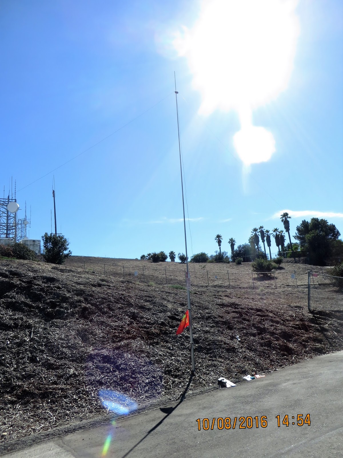
On Saturday afternoon, I made the trip up.  The actual summit is fenced off - it appears that there is a military radar installation and some commercial towers - so I set up my gear right alongside Crest Road road, next to the fence.  (I did make sure to put in a short road hike and carry my gear to the operating site, to keep within SOTA rules).  This was a much different mountaintop environment than what I am used to in Arizona!


I used a SOTABEAMS portable mast (unfortunately with a few top sections missing - they broke as described in a previous blog post below) and a SpiderBeams Aerial-51 404-UL OCF Dipole.  One end of the antenna was tied off to a trash can, the other to a rock, and the mast was strapped to a "No Parking" sign.


Within minutes of setting up, a police car drove up.  The officer asked what I was doing, and I explained.  Turns out he is familiar with amateur radio because a group of hams meets monthly at their station for Emcomm stuff, so he was satisfied and left without any trouble.  A little while later, a lady walked over from the house visible in the photo, and she wasn't quite as friendly.  She clearly did not want me there, and was concerned that my setup was permanent (ha!).

I ended up making just 14 CW QSO's, all on 20 meters, in the short time I was there.  I was using my KX2 and as far as the gear, was really enjoying some radio time.  Band conditions seemed fine and I'm sure I could have made many more contacts.  But unfortunately, the environment just wasn't the type of summit that really appeals to me.  Plus, my YL was waiting for me and we had to get ready for the race the next day.  So I packed up after only about 30 minutes of operating.

This summit is only 448m high, so it's only worth one point.  Such a contrast to the high Arizona peaks that have earned me 10 points (or even 13 with the summer bonus)!  But, it was my first activation from an Association other than W7A, so that was exciting.  After this activation I am now at 6 summits activated, with 57 points.

Oh, and yes the marathon went well :-)


17 September 2016

Activating Fort Bowie for NPOTA with the W7AI Gang

About 10 members of the Oro Valley Amateur Radio Club made a 2.5 hour drive to Southeastern Arizona on Saturday, September 17, 2016, for another National Parks On The Air activation.  This is OVARC's 7th activation for NPOTA this year, and it was my 2nd time joining them for the fun.


The operating location for this one was the Fort Bowie National Historic Site (NPOTA NS18), which was a military outpost in the 1800's when Arizona was still a Territory, and some infamous history was being made involving Native Americans such as Cochise and Geronimo.  There are still a few remnants of buildings on the site, which is nestled among the hills in an area that apparently was significant due to its proximity to a natural water source.


I carpooled with my friend Quinton NU7Y, who brought along the antenna we used.  It was a homebrew inverted V which we hoisted on a 30-foot push up pole.  Quinton parked his truck on top of a homemade mast stand, and an LDG auto tuner did a nice job finding optimal SWR for us.


The radio gear was supplied by Tom, W8TK, who has a nice box full of gear that he hauls out for these portable operations.  The rig was a Kenwood and we logged using N1MM.


Quinton snagged some nice DX on 20m CW including Belgium, Germany, and Slovenia.  We also worked a lot of stateside stations, all of who were happy to add NS18 to their NPOTA credits.  The antenna and rig were working very nicely, although propagation was a bit up and down.  We primarily worked 20m although George NG7A worked a few on 15m and we also tried 30m and 40m.  Other ops included Ken, Paul, Rick, and Steve, 

The OVARC club call sign is W7AI, obtained after one of our local hams, Ron W7AI became an SK.  Ron had been a friend of mine since the 1990's and I have many memories of shared amateur radio experiences with Ron, including Field Days on Mt Lemmon and trips to the Dayton Hamvention.  To be able to use his call sign for operations like these is quite an honor for me.


My operating these days is most often CW, but for this activation we were using both phone and code, and my time at the station was during the phone mode.  I had fun working stations all around the country, and the QSB was very interesting as we went from chaotic pileups to a totally quiet band in seconds.  That's one of the things I love about ham radio - the unpredictability.


We sure had a fun time and were on the air for about 4 hours.  During that time we made 171 contacts.  It wasn't a competition but towards the end we realized we might be able to make more QSO's than another club who had activated this same park, so we had a little fun squeezing out a few more to up the ante.  All in all we had a wonderful time and I'm looking foward to doing it again!


16 September 2016

VOACAP and VOAAREA - September's Monthly OVARC Meeting

The September meeting of the Oro Valley Amateur Radio Club has a nice presentation by Bill Hickey, AB7AA, on a pretty cool propagation prediction program.


VOACAP stands for "Voice of America Coverage Analysis Program".  It's a software program that allows hams to input certain relevant data (such as antenna type, height above terrain, and power levels), and produce a reasonably accurate model showing where signals will reach.


Propagation predictions are a bit like weather forecasts - they are often based on good science but there are too many variables involved to be 100% perfect.  Still, this looks like an interesting tool and I'm planning to play with it a bit.

10 September 2016

Mt Wrightson Hike and SOTA Activation

My interest in the Summits On The Air program continues to grow, and as a result I've become fascinated with the idea of hiking some of the local area peaks in Southern Arizona.  On Saturday, September 10, 2016 I was able to spend the day hiking and playing radio, and I had more fun than I even imagined.

My goal was to reach the summit of Mt. Wrightson, which is designated W7A/AE-014 in the SOTA maps database.  This requires a fairly strenuous hike but that was what I wanted - and I got it.  I knew it would be a long day so I packed 70 oz. of water, 2 bottles of gatorade, and food.  In addition, my pack had to carry my radio gear, emergency kit, and miscellaneous important stuff like toilet paper.  My wife looked at it and asked, "are you moving out?"  The pack was heavy - I weighed it after loading it up, and it came in at...over 26 pounds!  That's heavy, but it didn't include the antenna - which added another 14 pounds.  That 40+ pounds of weight is a lot, but I figured it would be manageable.


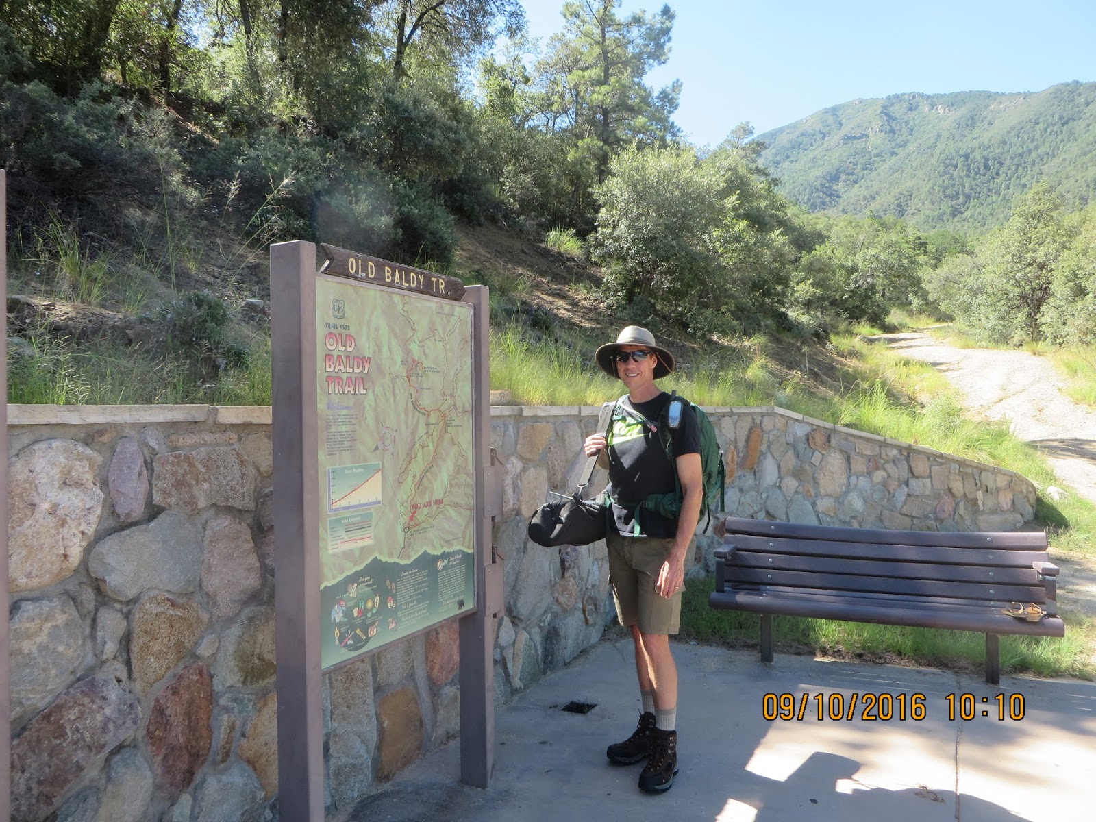
There are several options to hike to the summit.  I decided to start at the trailhead from the parking lot of Madera Canyon, which is just about a mile high in elevation.  I hiked on the Old Baldy Trail, which is steeper but shorter than the alternative from that area, the Super Trail.  Old Baldy was a nice trail, mostly rocky and a bit steep.  At various locations, I was able to see my target rising up ahead of me.


Much of the trail was shaded, which was a good thing because I didn't begin the hike until after 10 am, and the temperature was in the 80's.  The scenery was beautiful and recent summer rains had created plenty of green.  The hiking was slow, due to elevation, steep trail, and excess pack weight, but I was really enjoying the quiet and fresh air. I had my APRS beacon going out on my HT, but I don't think my signal made it out too many times.  My friend Quinton was watching online for my beacon, and did see me a few times.  In some places, the trail opened up to nice vistas looking out towards Tucson, and these were the best spots for APRS to get out.


I reached Josephine Saddle in a little under 3 hours.  At this point, there was almost a mile to go to the summit.  The views from the saddle were spectacular and I was excited to be getting close.  I was carrying my Buddipole in the sling bag and I was looking forward to giving my shoulders a break!  At this point in the hike, my shirt was drenched with sweat.


The final push to the summit started with a pretty meadow on the saddle, although the effects of a forest fire were evident.


Near the very top, the trail became very rocky and narrow, maybe even a bit dangerous.


The remains of an old fire lookout building are at the summit, but there were a few people already there, so I set up my antenna and equipment next to it.  I was tired after about 3.5 hours of hiking, and the elevation of about 9,500 feet made for thin air, but was looking forward to making some QSO's.  I set up the Buddipole for 10 meters (including hanging my new SOTA flag!), and called Quinton on the OVARC DStar repeater to let him know I was ready to go.  He was first in my log with a quick 10m CW contact.  I worked a few more stations on 10m, including WA7JTM Pete who was activating a summit in Yavapai County - that was a surprise, as the distance between us is normally too close for sky wave and too far for ground wave propagation.


I then switched over to 20m and began working the pileup.  I was struggling with the code for some reason.  Many mistakes were made and it seemed like I was having difficulty with the paddle making the correct number of dits in certain characters (i.e. "4" and "H").  It felt like the paddle was loose but I wasn't able to get it tightened; but really I think my problems were because (a) I was tired from the hiking, (b) I was experiencing some muscle trembles in my hand after carrying the antenna bag, which required me to hold it awkwardly to prevent slipping, and (c) I'm not the best code op anyway.  Nevertheless, I had great fun and worked 25 QSO's total.


At about 4:00 local time I realized that sundown was going to occur before I got down unless I left soon.  I was sad to pack up but really wasn't planning to hike in the dark, so I quickly took the antenna down, loaded everything up and began the trek down the mountain.  On the way down, I was caught in a refreshing rainfall for about 30 minutes or so.  The downhill allowed me to go much faster, and I reached the canyon parking lot after about 1 hour 45 minutes.

This was really such a fun day.  There are two other peaks close to Wrightson - Josephine Peak will require a similar hike, while Mt. Hopkins can involve a hike but it's also possible to drive much closer.  I could easily see them both during my hike, and I'm hoping to activate both eventually.  According to the SOTA Mapping Project page, both summits are worth 10 points due to their peak elevation.  I really like the mapping page, and after this hike I uploaded my Garmin's .gpx track file for the climb up to help other users of their database.


05 September 2016

Constructing a Linked Dipole

One project I'm currently working on is to build a "Linked Dipole".  This antenna is just a simple wire dipole, but it has breaks along the wire that can be either connected or disconnected, allowing the antenna to be tuned for one of several different bands.  I expect this will be a useful antenna for portable operations; in fact we used my friend NU7Y's linked dipole very successfully on my first SOTA activation.

The SOTA website has an excellent calculator app that I used to determine approximate lengths of wire for each side.  My goal was to build a dipole that will cover the 15, 17, 20, 30, and 40 meter bands.  After putting in my parameters, here is what the app recommended for my design (note this is only one side, the dipole requires two for each side).


I used some 14-gauge "THHN" style wire that I obtained from the local Home Depot.  The coating on THHN wire does have some effect, but I was willing to sacrifice a little perfection in exchange for the low cost of this wire and for my first attempt at this particular antenna design.  I cut each length approximately 10cm longer than suggested, with the plan to trim them down to obtain optimal SWR (it's much easier to trim shorter than extend longer!)

For easy connect/disconnect, I decided to try using Anderson Powerpoles.  One side uses all red, and the other side uses all black - that helped me keep things straight during the building process.  I used a label maker to indicate which band each wire section was cut for.  I began by placing a powerpole on only one side of the wire; the other side was left bare until I had trimmed it to the correct length, after which the second powerpole was crimped on.  The powerpoles do work, but if I build another linked dipole, I do not think I'll use them again, because they come apart a little too easily - it's likely I will need to reinforce the connection when the antenna is hanging for use.  I've seen other designs use alligator clips and even bolts to hold things together.

I also used a short piece of parachute cord to keep the dipole together when the powerpoles are disconnected.  Tie-wraps hold the cord and wire together, with a few drops of super glue to create a pretty solid bond so they don't slip.  Like the second powerpole, the cord was not connected until that section had been trimmed down to the correct length.  Here is a close-up of one of the links (note the whole antenna has a total of eight links):


I set the antenna up in my back yard for testing and trimming.  I also thought this would be a good chance to practice setup of the entire antenna system, including an extendable mast.  I had acquired a 10 meter pole from SOTABeams, a store in the UK which caters to SOTA enthusiasts.  10 meters is quite high and to make a portable mast, the poles become extremely thin at the top.  So thin, in fact, that most photos you see of them show considerable bending at the top.

So, I thought bending was normal and proceeded to hang my antenna on the top section and hoist it up.  I had each side of the dipole connected to a balun, and a run of RG58 coax connected to the balun.  As the mast went up, it began to bend.  Unfortunately, the weight of the balun and antenna were too much for the tiny top sections, and I only had it extended about 10 feet up when I heard a loud cracking sound and the mast bent in an ugly downward v-shape.  My brand new mast broke on my first try at setting it up!


It was quite a disappointment but I suppose it's better to have this happen in my backyard than after I have traveled to some remote site.

I still wanted to complete the antenna construction, so I set my frustrations aside and went to plan B.  I have a fairly sturdy tripod mast from MFJ, one that is most definitely NOT light enough to carry on a hike but is good for home use (I usually have a magnetic loop antenna hanging on it inside the house).  So I brought it out and set it up, and proceeded with the somewhat tedious process of fine-tuning the link element lengths.

I began with 15m, and once it was reasonably tuned I connected the 15m/17m link and tuned for 17.  Next up was 20m, which much to my surprise turned out to be too short!  This was not a huge problem, but I did need to re-cut a longer length of the wire and replace this section.  Then I moved on to 30m, and finally 40.  For the 40m section, I have left it intentionally long until I get out in the field with the antenna.  Once I'm in the field, I will either trim it down or determine a fold-back method to effectively shorten it to the best SWR.  I actually would have preferred to do this at home, but my back yard is just a bit too short, and it was getting too hot (105F) to continue the work.

Here are some SWR measurements of the various bands:


Certainly this is not the perfect antenna, but it does look like it will be a useful piece of gear for some of my ham radio portable operations.  I wound each side around kite winders for simple transport and deployment.  Now I just need to find a better mast solution.  It could be hung up in trees as well, but many of the peaks in Arizona that I may hike to won't have any trees available.  I realize that the real test will be how well it can perform, but I know what to expect from dipoles and this does appear to be a great way to get 5-band capability from a single antenna, at a very low cost.  I'll probably build another one to cover the 10 and 12 meter bands.


01 September 2016

Wallpaper From SOTA!

My first SOTA awards have arrived!  These two are basic Chaser awards - a fun start to my SOTA wallpaper collection, which I hope will eventually expand to include Activator awards as well.


The Chaser awards are given for contacts made from my home QTH to stations that are activating a summit somewhere.


Most of my QSO's so far as a Chaser have been with stations in WA, OR, CA, NM, and CO.  This is partly due to my current HOA-limited home station, and partly due to generally weak propagation conditions.

Sometimes I log in remotely from my office to my home, and make a QSO using the CWX function of my SDR.  But I prefer to use an actual code paddle when possible instead of computer-generating the CW, it's just more fun.


25 August 2016

NPOTA Activation - Tumacacori - 100th Annversary of National Park Service

Today is a special day for the great outdoors.  On this day, 100 years ago, the National Park Service was founded in the USA.  While I'm not a fan of big government, I do love nature and I'm glad there are protected places where nature is protected.

To honor 100 years of national parks, the American Radio Relay League coordinated with NPS and created the "National Parks on the Air" event.  For the entire year of 2016, amateur radio operators are encouraged to visit parks and "activate" them.  Other operators are encouraged to "chase" the activators, i.e. the goal is to promote the parks by having people make contacts from within park boundaries with others around the world.

Our local club, Oro Valley Amateur Radio Club, has done several NPOTA activations this year from nearby national parks.  This morning, we set up bright and early at the Tumacacori National Historical Park (designator HP45).  We were ready to roll before sunrise!


Tumacacori also happens to lie along the 1200-mile Juan Bautista de Anza National Historic Trail (designator TR13), so we were able to provide a double NPOTA activation to chasers.  We set up a single station, so we had plenty of operators to share duties.  We all used the OVARC club call sign, W7AI.


Operations began with SSB on 40 meters, then CW on 40.  A few others ran the station while I observed and assisted with the donuts :-)

After a while, I took over and operated 20m CW.  We were using N1MM to log, which has an automatic keyer, but I also used a nice paddle.  We were spotted on the DX cluster which helped draw chasers, so I was able to run on 14.043 for a while.


Most of the station gear was supplied by Tom, W8TK.  We ran 100 watts from a Kenwood TS590 into an end-fed half-wave, with the top up around 30 feet on a portable mast.  This was a nice portable setup, although band conditions were moderate at best.  We worked stations pretty much across the US and Canada.


I left a bit earlier than the others, because it's a work day and I needed to get to the office.  When I  left, we were hovering around 100 contacts, and hopefully they pulled out a few more QSO's before breaking down.  The park officials had invited us to a birthday cake and ice cream celebration at 10am, but I wasn't able to stay that late.


This was my first NPOTA activation, and I sure enjoyed it.  I think OVARC will have a few more before the end of the year and I'm hoping I'll be able to join in on the fun again!